Open Digital Planning: Month 10
March 2026 — Digital Planning Improvement Fund — Cohort 3
Summary
March has been a whirlwind of activity, and while our project report was finalised slightly early due to end of annual leave period, momentum behind our digital transformation remains strong. I’m just back from a sunny trip to the Isle of Wight. Spring is truly underway (with a slight rainy hiccu...
March has been a whirlwind of activity, and while our project report was finalised slightly early due to end of annual leave period, momentum behind our digital transformation remains strong. I’m just back from a sunny trip to the Isle of Wight. Spring is truly underway (with a slight rainy hiccup).
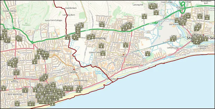
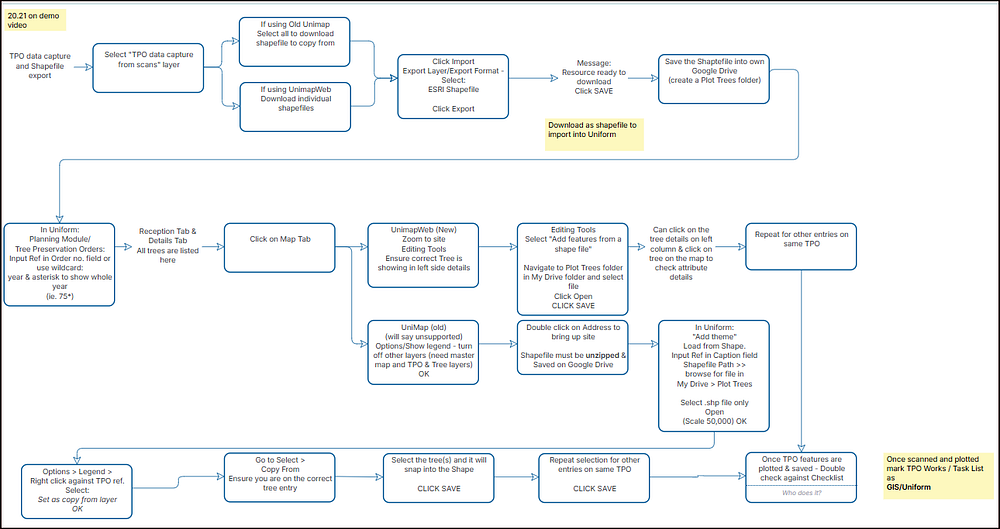
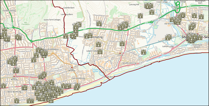
Major Funding Wins We are thrilled to announce that both councils have successfully secured funding through the MHCLG Digital Planning programme. That means we have funding to implement Plan X via the adoption fund and improve our process and systems via Track 2 Development Funds. This is a massive win for the team following intensive work throughout last year. It is a reward for our long-term commitment to improving planning services for our residents, local businesses, and officers. Press Release: Transforming planning with PlanX and new funding to help local planning authorities reap the rewards March Successes Despite the shorter reporting period, the team has hit several key milestones: Tree Preservation Orders (TPOs): We have completed the manual scanning and PDF conversion of all available TPO paperwork. Additionally, Adur TPOs have been fully plotted. Great work has been done to document the process for capturing TPO data.
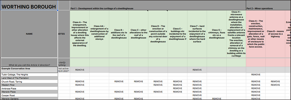
Self-Build Register: This work is now complete, providing a significantly simpler and more automated method for annual data collection. PlanX & Track 2: Onboarding and kick-off sessions for both new funding streams are already underway, laying the groundwork for the next phase of our digital journey. PlanX Preparation on Permitted Development data on Article 4. Using the Open Systems Lab template, the Article 4 Directions have been collated based on our published GIS data.This process highlighted discrepancies in a few Permitted Development rights, which will be verified by the Principal Planning Officer before the sheets are submitted.
Development rights Listed Building Data: As part of our commitment to data integrity, we are currently performing a final check and review of our Listed Building polygon data to ensure everything is accurate before the next phase of publishing.
Historic England hold references to all our Listed Buildings, however most of this is point data rather than more accurate outline polygon data.
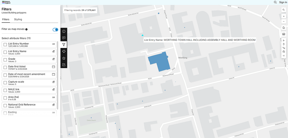
The team has painstakingly looked at each part of the listed building data for our buildings, temporarily tracking progress on a detailed spreadsheet. Challenges & Constraints As we reach the end of the financial year, our primary challenge has been capacity, as many team members take well-earned annual leave. We have also encountered some technical hurdles regarding the sheer volume of scans we are attempting to publish, but work is already in progress to resolve these bottlenecks. What’s Next? As we head into April, our focus remains on completing our core datasets and starting our new funded workstreams: TPO Completion: We aim to plot as many Worthing TPOs as possible and upload the full dataset by the end of the month. Local Plan Alignment: We have caught up with the Planning Policy team to ensure our work aligns with their focus on the Local Plan for the new year. Backend Improvements: We will officially begin work on backend service improvements using our Track 2 funding.